
 cleveland.com
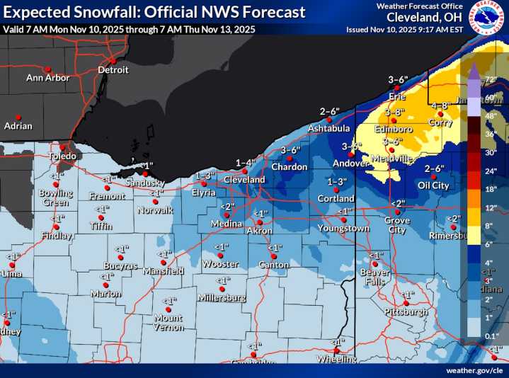
CLEVELAND, Ohio — Northeast Ohio’s first snow of the season continues to unfold Monday, with bursts of lake-effect snow expected through the evening and into Tuesday morning before conditions gradually ease.
Bands of snow off Lake Erie have already coated much of the region, particularly across the higher terrain east and south of Cleveland.
Early Monday morning reports to the National Weather Service showed 2 to 4 inches of accumulation in many spots — including 4 inches near Hinckley, 3.6 inches in Bath, and about 3 inches across Brunswick, Concord and Doylestown.
Lesser amounts were reported closer to the lakeshore, where temperatures have held just above freezing.
More snow ahead for snowbelt counties
Additional accumulations of 2 to 5 inches are expected through Tuesday morning,

 Akron Beacon Journal
 WFMJ-TV
 Pittsburgh Post-Gazette
 OK Magazine
 America News
 Atlanta Black Star Entertainment
 The List
 ESPN NFL Headlines