
 KNOE
KNOE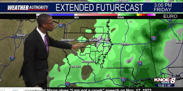
Our stretch of warm weather continues, with rain chances returning later in the week. Today, temperatures will reach the low 80s under a mix of sun and clouds. Highs hover in the 80s through Thursday, near record levels. A stray shower or thunderstorm is also possible on Thursday ahead of our next cold front. However, the best opportunity for rain is Thursday night and Friday. Once the front passes, cooler and drier air moves in for the weekend. By Sunday, highs will be in the mid 60s.
Today: Partly cloudy with highs in the low 80s.
Tonight: Mostly clear with temperatures falling into the low 60s.
Tuesday: Partly cloudy with highs in the low 80s.
Wednesday: Partly cloudy with highs in the low 80s.
Thursday: Mostly cloudy with highs in the low 80s. A stray shower or storm is possible.

 Alabama News Network
 WRCB-TV
 Sweetwater Now
 WSIL-TV
 WHAS 11
 CNN Climate
 New York Post
 WMAR-2 News
 Arizona's Family
 Times Herald-Record
 WREX
WREX PennLive Pa. Politics
 @MSNBC Video