
 WAAY TV
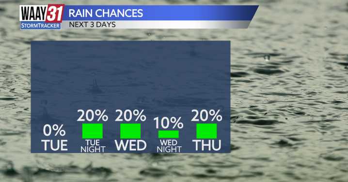
Today's forecast will feature warmer than average temperatures once again, despite the increasing cloud coverage throughout the afternoon. As we are going to bed, some isolated showers will push through, bringing some heavier rain at times.
By Wednesday morning, the rain will have already moved out of the Tennessee Valley, and it will remain overcast for the rest of the day. Thursday features much of the same, with highs in the mid to upper 70s both days.
A cold front will push through on Friday, bringing scattered rain and a few thunderstorms along with it. Right now, severe weather is not expected with this system. Behind the front, cooler air moves in, with highs near 70 for the weekend.
TUESDAY: Mix of clouds and sunshine, gusty wind. High temperatures in the mid-70s. Wind: SW 10-15

 WVLT
WVLT abc27 News
 AccuWeather Severe Weather
 The Bay City Times
 WIS News 10
 WMTV NBC15
 WYMT
WYMT Courier Journal
 14 News
 KRIS 6 News Weather
 Newsweek Top
 Page Six