
 KSNB Local4 Central Nebraska
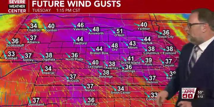
HASTINGS, Neb. (KSNB) - Good Monday evening everyone! After a quiet and cool day today, the weather pattern turns active and much colder through the holiday week.
Partly cloudy skies this evening will gradually clear overnight. A cold front will plow across the area later tonight through early tomorrow morning. Behind this cold front, winds will ramp up out of the northwest and become quite strong. Some of the strongest winds will be over Northern Nebraska where gusts up to 60 mph will be possible. They’ll be a little lighter farther south. Most will still see gusts of 40 to 60 mph. Meanwhile, it’ll also be a chillier day. High temperatures will range from the mid 30s northwest to near 50° in the southeast. There is some small concern behind the front that some wintry precipitation that c

 Idaho News 6
 KTVB 7
 KETV Omaha
 48 Hills
 CNN
CNN Newsweek Top
 The Daily Beast
 America News