
 The Bay City Times
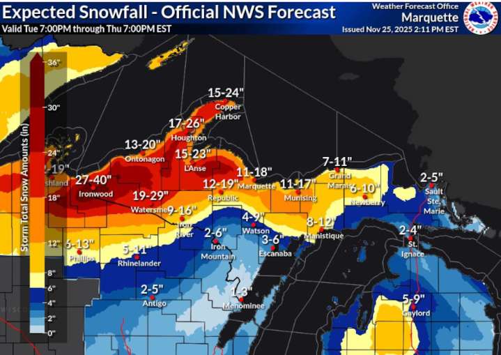
UPPER PENINSULA, MI - Forecasters are warning that blizzard conditions are expected across a swath of the Upper Peninsula today, and they expect it to severely impact visibility on the roads. The National Weather Service is saying travel could become very hazardous as this powerful winter storm system kicks into a higher gear today.
So that means people should be timing their travel windows - this won’t be the weather that you want to be out in if you have to zip to the store for another Thanksgiving pie or gallon of milk.
The western area of the U.P. and counties that hug the Lake Superior shoreline are going to see the heaviest snow today. Some areas could see 3 to 4 feet of snow pile up by Thursday night. High winds combined with the snowfall are going to set up conditions that make

 Newsweek Top
 Daily Voice
 Associated Press US and World News Video
 TIME
TIME The Shaw Local News State
 NBA
NBA RadarOnline