
 WREX
WREX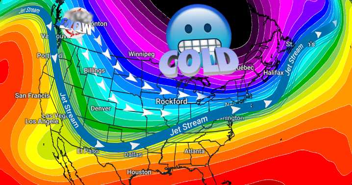
Tonight brings another subzero night, but temperatures throughout much of the extended forecast won't be as bone-chilling, but it does look more snowy.
Temperatures dip just below 0° again late Thursday evening with wind chills dropping to around -10°. Warmer air will be creeping in overnight, allowing temperatures to climb to around 10° with wind chills around 0° by the time we're awake and moving Friday morning.
Clouds will be increasing in coverage throughout the day, leading to overcast skies by the afternoon. A few flurries or light snow showers are possible Friday evening, but minimal impact is expected.
More "clipper" systems are expected to slide through the area this weekend and next week. Each system may have just enough snow to cause minor travel disruptions, but the accumula

 Daily Voice
 ABC News Weather
 KGNS
KGNS WCNC Charlotte Weather
 Sweetwater Now
 Cheboygan Daily Tribune
 KSNB Local4 Central Nebraska
 KRIS 6 News Weather
 The Shaw Local News State
 AlterNet