
 The Mercury News Crime
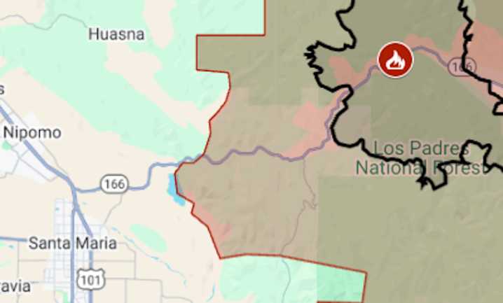
California’s Gifford Fire surpassed 100 square miles in its third day, forcing new evacuation orders in San Luis Obispo and Santa Barbara counties.
At the end of Sunday, Aug. 3, the wildfire was mapped at 65,061 acres (101 square miles) — an increase of more than 25,000 acres for the day, said fire managers for the U.S. Forest Service. Gifford is the second-biggest California wildfire this year, having surpassed Palisades on Saturday.
Evacuation orders covered almost 600 square miles. Highway 166 was closed between Highway 101 and New Cuyama.
The map above shows the evacuation area in red and the approximate fire perimeter as a black line. Shown as a gray tone is the perimeter of last month’s Madre Fire , the biggest California wildfire this season, at 80,779 acres.
Gifford was

 Local News in Arizona
 CNN
CNN Associated Press US and World News Video
 FOX 13 Tampa Bay Crime
 Denver7 News
 KLKN-TV Lancaster County
 CBS News
 TMJ4 News
 Newsday
 New York Post
 Raw Story