
 The Mercury News Crime
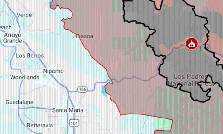
A week after it started — and three days after it became California’s biggest wildfire of the year — the Gifford Fire was mapped at more than 100,000 acres.
As of Friday morning, the fire had burned 101,933 acres (159 square miles) in San Luis Obispo and Santa Barbara counties, with 15% containment, said fire managers for the U.S. Forest Service.
On Thursday, Gifford spread rapidly at its northwest corner, about 20 miles inland of Pismo Beach. Fire crews were forced to withdraw for safety reasons, the Forest Service report said, and evacuation orders were expanded. By the end of the day, the evacuation zone covered 840 square miles, including the rural community of Huasna and Lopez Lake Recreation Area. Almost 3,000 structures were threatened.
The map above shows Gifford’s evacuation

 Local News in Arizona
 CNN
CNN Associated Press US and World News Video
 FOX 13 Tampa Bay Crime
 KLKN-TV Lancaster County
 CBS News
 TMJ4 News
 New York Post
 Newsday
 The Shaw Local News State
 Oh No They Didn't