
 WSIL-TV
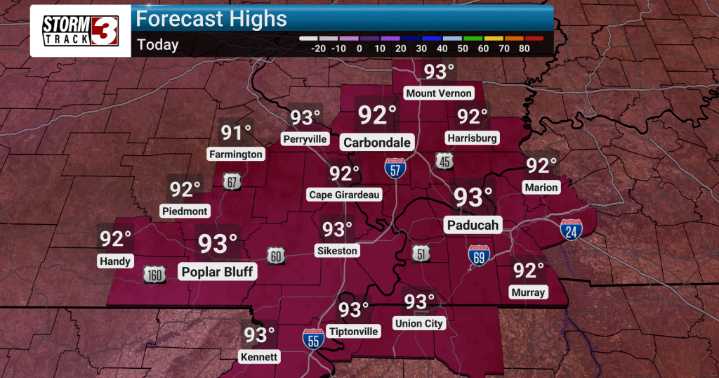
Another classic stretch of summer weather is forecast for our region, with what we expect to be typical summertime heat continuing for the next week.
We've been keeping a close eye on the patterns, and we anticipate daily highs to generally hang out in the upper 80s to low 90s. Factor in those humidity levels, and we're looking at heat index readings potentially reaching between 95 and 100 degrees.
Currently, we're forecasting dry conditions to hold steady through the upcoming weekend. We'll see a mix of sun and clouds, with plenty of heat.
However, as we push into next week, our models suggest a slight shift. Around Tuesday and Wednesday, we may see an upper-level disturbance approach, which could provide the focus for some scattered showers and thunderstorms.
This could also lead to

 America News
 KXLH
KXLH KSNB Local4 Central Nebraska
 Detroit News
 KCRA News
 Lansing State Journal
 Sarasota Herald-Tribune
 ABC News
 TMZ
TMZ