
 WAAY TV
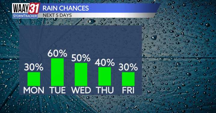
Higher rain chances in store to start off the work week, with a few localized stronger storms possible which could bring heavy rain, gusty winds, and frequent lightning.
Showers already present over in Sand Mountain this morning, and that will continue as we go through the rest of the day today. Most of the rain will stay to the east of I-65, but a few pop-up showers over in the Shoals won't be out of the question. Highs today will sit around 90, with lingering humidity.
Tuesday and Wednesday look to be the wettest out of the week, with showers and storms starting in the morning and lasting throughout the day. Some of these storms could pack a punch, however none of the Tennessee Valley is under any severe weather threat.
Wednesday and Thursday feature mostly cloudy skies with afternoon

 America News
 Associated Press Top News
 WWSB
WWSB Lansing State Journal
 The Oregonian Public Safety
 Bozeman Daily Chronicle
 KOLO8
KOLO8 Raw Story