
 KIMT News 3
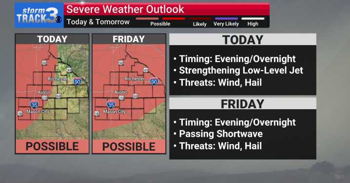
(KIMT) -- A dynamic day of weather for your Thursday will feature another round of near-seasonable temperatures in the upper 70s to low 80s. Cloud cover will be a huge factor in determining high temperatures Thursday. A batch of showers and storms along a warm front to our west will move into our region by the afternoon.
If this batch of showers/storms holds together, we will likely see a thick cloud deck, therefore reducing our high temperatures to the mid 70s for Thursday. On the contrary, if precipitation falls apart, peeks of sunshine will be seen in the afternoon, keeping high temperatures as forecast.
Starting Thursday, a southern ridge of high pressure will build into the Upper Midwest. As this heat dome sets up, a parade of shortwaves will start to traverse through southeast Minn

 KWQC
KWQC WOWT Crime
 KCRG Iowa
 HealthDay
 Washingtonian
 Raw Story
 Mediaite
 The Monroe News
 Oh No They Didn't