
 WYFF Greenvile
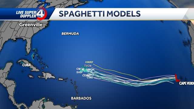
GREENVILLE, S.C. —
Tropical Storm Erin shifted a bit west Thursday but most models still show a "recurve" that would steer the storm away from the U.S. coastline this weekend.
Erin is on track to strengthen into a hurricane, the first of the Atlantic season, by Friday morning and into a major hurricane by Sunday morning.
Hurricane Stats
The models on Thursday have shifted the track a little farther west, slightly closer to the Carolina coast.
The storm will likely pass in between the U.S. & Bermuda Tuesday into Wednesday.
Erin is expected to bring dangerous rip currents, high surf and significant waves to the eastern coastline.
For now, most forecast guidance keeps Erin over open waters through the week, with many models showing a classic northward “recurve” that would steer the sto

 The Weather Channel
 FOX Weather
 WESH 2 News
 The Greenville News
 WIS News 10
 WRDW-TV News 12 Crime
 TIME
TIME