
 The Danville Register & Bee Politics
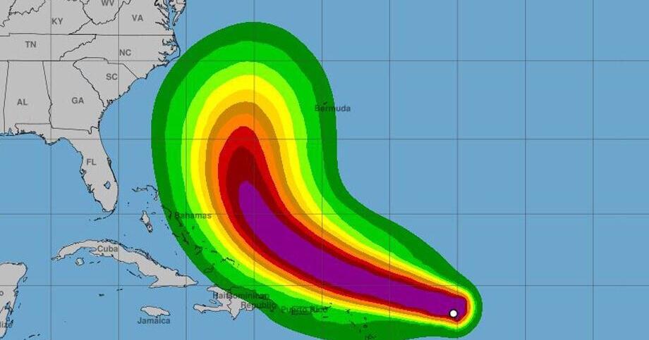
SAM MOSTOW Richmond Times-Dispatch
Erin grew into a Category 4 hurricane by Saturday morning.
The first hurricane of 2025 — and fifth named Atlantic storm of the season — is advancing through the ocean toward North America.
“The big question remaining is how fast does the storm turn,” said Jeff Orrock, the meteorologist in charge of the National Weather Service in Wakefield. “For us, Monday will be a pivotal day to see if it can turn fast enough to stay offshore. If it turns a little bit slower and it looks like it will come a little closer to the coast, it will mean a few more coastal impacts.”
More coastal impacts would result in higher waves and tides, along with more wind along the coast and Chesapeake Bay. The National Weather Service is closely monitoring potential impacts.
“Eri

 America News
 WISC-TV Channel 3000
 FOX 13 Tampa Bay Crime
 AccuWeather Severe Weather
 CNN
CNN New York Post
 Canada News
 Salon
Salon