
 Charleston City Paper
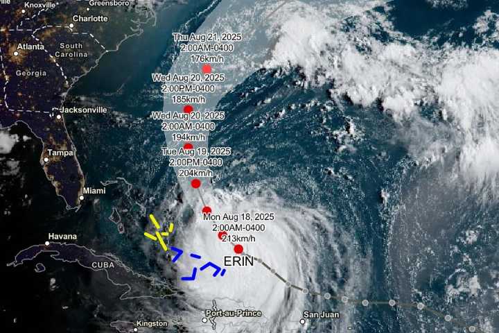
MORNING HEADLINES | A sprawling, powerful Hurricane Erin is churning toward the mid-Atlantic but is not to directly pound the U.S. coastline. But that doesn’t mean it won’t have a major impact as forecasters are warning of rip currents and towering waves along the Eastern seaboard.
According to a National Hurricane Center advisory this morning, the storm, which returned to Category 4 strength in recent hours, is located just east of the southeast Bahamas and is about 890 miles south-southeast of Cape Hatteras, N.C.
A gradual turn to the north is expected later today. The storm is expected to move between Bermuda and the east coast of the United States by mid-week.
In other headlines
CP OPINION, Brack: Political crazy seems to be winning . “A drone’s view of what’s happ

 News on 6
 AccuWeather Severe Weather
 CBS DFW
 Local News in South Carolina
 America News
 WISC-TV Channel 3000
 Democrat and Chronicle
 FOX 13 Tampa Bay Crime
 New York Post
 Denver7 News
 CBS Mornings
 5 On Your Side Sports
 AlterNet