
 KBTX News 3
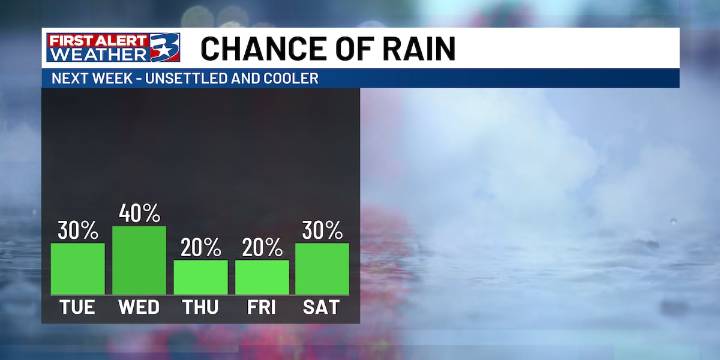
BRYAN, Texas (KBTX) - Following our warmer and drier period at the start of the week, we will start to see some changes by mid-week as rain chances make their way back onto the board.
SET UP:
High pressure centered over New Mexico will keep us dry and warm through Monday. By Tuesday, however, a weak frontal boundary sliding across the lower 48 will move into Texas before stalling out over Southeast Texas. This will kick start rain chances from Tuesday through the weekend, as said boundary is expected to linger about the area.
Heading into a more unsettled and cooler weather pattern (KBTX)
The question is whether that rain ends up more isolated or widespread, which depends on exactly where that boundary sets up each day.
IMPACTS :
Still, where rain does fall, it will be efficient, e

 Click2Houston
 WFAA
WFAA KENS 5
 The Intercept
 CNN Politics
 Glam
Glam NHL
NHL NECN Providence