
 KRQE News 13
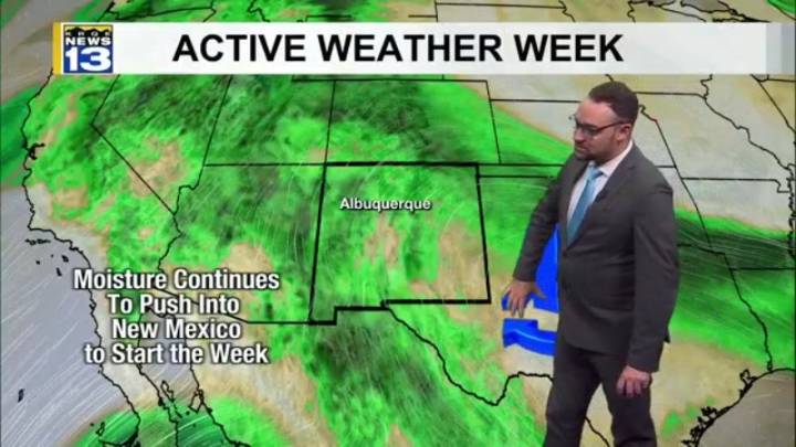
Another round of afternoon showers and storms developed across the northern half of New Mexico this afternoon and evening. Monday will be very similar to today, but a backdoor cold front will begin moving into northeast New Mexico which could cause some heavier rainfall amounts along the Sangre de Cristo Mountains.
The backdoor cold front will push south across New Mexico Monday night through Tuesday. This will increase the moisture in the atmosphere and bring in much cooler air by Wednesday. Rain chances will increase across northern, central, and eastern New Mexico Tuesday. Even heavier rain will be possible Wednesday through the end of the week as the cold front combines with monsoon moisture to bring widespread chances for rain and storms across the state. For western New Mexico this

 KPTV Fox 12 Oregon
 The Oregonian Public Safety
 KBTX News 3
 WCBI-TV
 WKOW 27
 ABC News Weather
 Newsday
 FOX News Travel
 First Alert 4 Sports