
 CBS Colorado
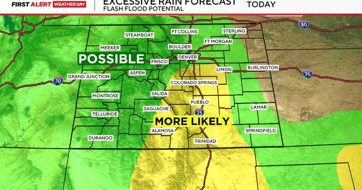
This week Colorado is enjoying a break from the heat with a cooler and wetter weather pattern. A First Alert Weather Day has been issued due to the increased risk for localized flooding.
CBS
An active weather pattern is expected across much of the state this week, bringing daily chances for rain and thunderstorms, especially along the I-25 corridor and in the high country. Temperatures are also expected to remain below normal.
CBS
The highest potential for widespread showers and storms arrives Monday afternoon. Storms are expected to develop over the mountains and foothills before pushing east toward the Front Range and the plains. Some areas could see brief but heavy downpours, with rainfall totals reaching 1 to 2 inches in under an hour in isolated spots. That increases the risk of f

 Kitsap Sun
 KPTV Fox 12 Oregon
 Battle Creek Enquirer
 ABC News Weather
 The Oregonian Public Safety
 KBTX News 3
 WKOW 27
 KSNB Local4 Central Nebraska
 Lansing State Journal
 Newsweek Top
 Mediaite