
 Northern News Now
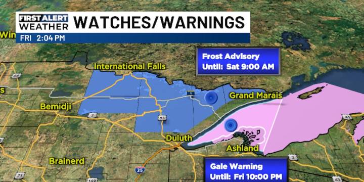
WEATHER STORY: The age old clash of the air masses is battling over our Northland this weekend. The cool ones of the north will have the upper hand to start. That means another Frost Advisory for the Iron Range Friday night and Saturday morning. As the frontline of the masses wobbles around, showers will be triggered but not much accumulation will come down. By Sunday, it will start to clear and it will start to warm as the conflict of northerly wind versus southerly wind takes a turn towards the south. Normals this week: low 47 and high 67.
WEEKEND FORECAST AT A GLANCE: Minnesota - showers Saturday but sun Sunday, highs 58-62, winds NW 5-15. Wisconsin - showers Saturday and sun Sunday, highs 59-65, winds W 5-10. Upper Michigan - showers Saturday with sun Sunday, highs 55-

 The Weather Channel
 KTVB 7
 KSNB Local4 Central Nebraska
 Eyewitness News 3
 Joplin Globe
 New York Post
 The Bay City Times
 FOX Weather
 Post Register