
 CBS Philly
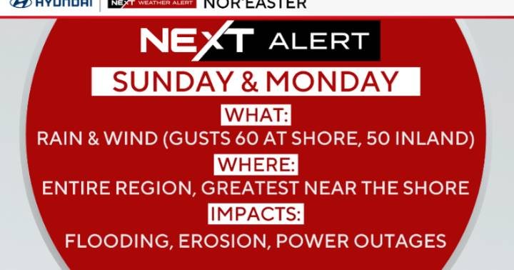
As of late Saturday evening, the low is positioned off the South Carolina coast, marking the start of the nor'easter's impacts for our region. Forecast models now show a possible "double-barreled" setup, with a secondary low developing closer to Long Island on Sunday. This evolution could keep the strongest winds and heaviest rain closer to the coast while lowering rainfall totals slightly farther inland.
CBS News Philadelphia
The coastal storm will continue to affect the region through Monday, bringing periods of rain, gusty winds, and coastal flooding, especially along the New Jersey and Delaware shorelines. Conditions will slowly improve Monday night into Tuesday as the system weakens and drifts out to sea. High pressure will then build in mid to late week, setting up a stretch of

 America News
 KPTV Fox 12 Oregon
 Santa Maria Times Local
 WITN-TV
 Denver7 News
 KSNB Local4 Central Nebraska
 Newsday
 Rolling Stone
 The Babylon Bee