
 Action News Now
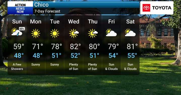
You can expect showers to continue through Sunday, with the heaviest amounts generally expected north of Interstate 80, impacting areas like Shasta and northern Tehama counties. For those northern mountain and foothill areas, this could mean over a quarter-inch of rain. We're also watching for the possibility of thunderstorms developing Saturday afternoon and evening, particularly north of I-80 in areas like the northern Sacramento Valley and nearby terrain. These are not typical for this time of year and something we will be monitoring closely. Winds will also be on the gusty side, especially in the Sacramento Valley, with gusts potentially reaching up to 40 mph this afternoon before diminishing.
As we move into Sunday, winds will remain breezy but not quite as strong. The good news is,

 WDHN News
 WAAY TV
 Local News in New York
 WAND TV
 FOX 13 Tampa Bay Crime
 Reuters US Top
 People Human Interest
 WWSB
WWSB Associated Press Top News
 AlterNet
 RadarOnline