
 WVTM 13
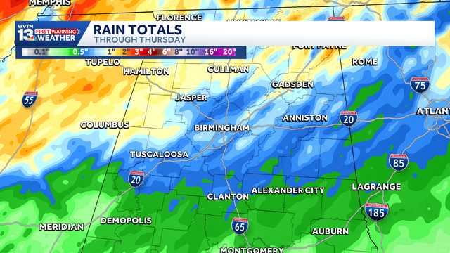
FULL FORECAST | FIRST WARNING LIVE RADAR | WAYS TO STAY SAFE IN SEVERE WEATHER | UPLOAD YOUR WEATHER PHOTOS | TURN ON WEATHER NOTIFICATIONS
Wednesday has been designated a First Warning Impact Day due to a chilly and blustery rain moving into Central Alabama.
We declare a First Warning Impact Day because of weather that could be impactful to your normal daily routine.
It is important that you have a way to get the latest information. Download the WVTM 13 app and turn on alerts here .
Watch the latest forecast in the video player above.
Hearst Owned
Rain begins to move into West Alabama Tuesday night and continues through Wednesday.
The morning commute will be messy, with pockets of heavier rain likely along Highway 278.
Rain should taper off late W
 AP Breaking News
 Associated Press US and World News Video
 FOX 5 Atlanta Crime
 Associated Press Top News
 NBC4 Washington
 AccuWeather Severe Weather
 ScienceAlert en Español
 Reuters US Domestic