
 News4JAX
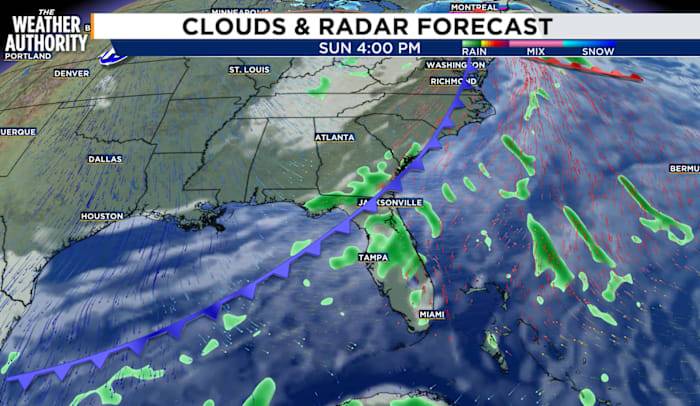
Tonight will be mostly cloudy and mild. Low temperatures will be in the 50s and 60s. Areas of dense fog will be likely away from the cast.
Our area will remain ahead of a strong cold front on Sunday, so we will see more of the same. Highs will climb into the upper 70s to low 80s with a few isolated showers and storms. Big changes are on the way early next week as we transition to a winter-like pattern behind a strong cold front.
The front will cross our area Sunday night and will bring the coldest air of the season to the Southeast early next week. Monday will be breezy behind the front and high temperatures will struggle to climb out of the 50s. Tuesday will be even colder.
Many locations will fall into upper 20s to mid-30s Tuesday morning. Patchy frost will be possible, especially awa

 KLFY News 10
 Spectrum News Louisville
 WAAY TV
 WISC-TV Channel 3000
 FOX 5 Atlanta Crime
 The Weather Channel
 WKOW 27
 The Bay City Times
 Akron Beacon Journal
 KPTV Fox 12 Oregon
 Newsweek Top
 WMTV NBC15
 KWTX News 10
 Essentiallysports Football