
 WSIL-TV
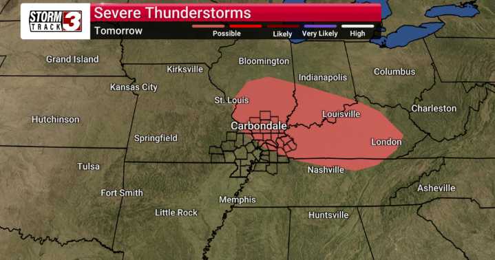
It looks like we're in for quite an active stretch across Southern Illinois and the surrounding Mid-Mississippi River Valley.
Starting tomorrow, thunderstorms are likely throughout the morning, with scattered storms possible in the afternoon. We'll be keeping a close eye on these storms as they may produce some hail.
As we move into Wednesday, things will quiet down significantly, with overcast skies and a cooler high of 58. However, the trend shifts rapidly as we head into Thursday and Friday. We’re expecting cloudy conditions with periods of rain each day, and there's even a possibility of thunder.
The main concern over the next few days is the potential for severe weather, particularly on Tuesday. Models indicate the potential for large hail and even an isolated tornado in our viewin

 FOX 32 Chicago
 AccuWeather Severe Weather
 FOX 26 Harris County
 CBS Los Angeles
 The Advocate
 KPTV Fox 12 Oregon
 WNNY-TV
 The Bay City Times
 23ABC News Bakersfield
 WMUR TV
 AlterNet