
 WKYT
WKYT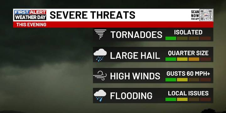
LEXINGTON, Ky. (WKYT) - We’re kicking off a very busy stretch of weather today as waves of showers and a few stronger thunderstorms move across the region. This is only the first act, too—another soaking system arrives late in the week and lingers into the first part of the weekend. All of this is part of the bigger shift toward a more winter-like pattern as we head into Thanksgiving Week and the weekend that follows.
Let’s zero in on today before we jump ahead. Rain and thunderstorms push in early, with the heaviest coverage setting up across the northern half of Kentucky. A few spots in the northeast could even see a brief mix to start. When you get this kind of tight temperature contrast, it can help storms strengthen, and that’s why we have a low-end severe threat later this afternoon

 AccuWeather Severe Weather
 Miami On The Cheap
 Real Simple Home
 AlterNet
 The Newport Daily News
 Pittsburgh Post-Gazette
 People Food
 The Weather Channel
 Salisbury Post
 CBS News
 Oh No They Didn't