
 WKYT
WKYT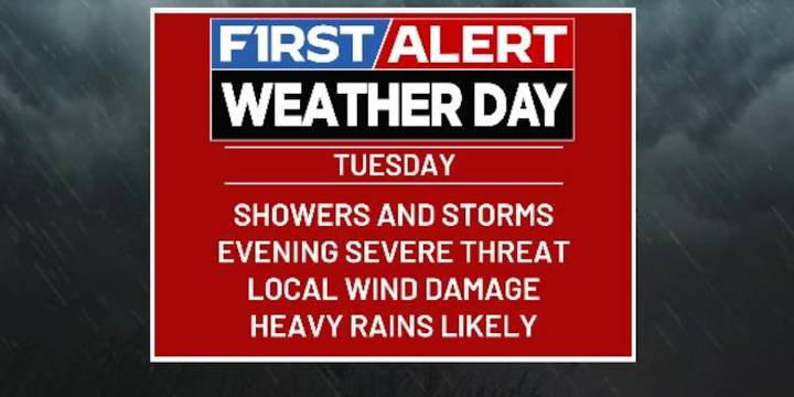
LEXINGTON, Ky. (WKYT) - Our new week is off and running on a seasonable temperature note but that won’t last. Milder temps will bring along very wet weather in the coming days with the chance for thunderstorms to show up. This action packed pattern is ahead of the transition toward winter for Thanksgiving week and, especially, weekend.
Clouds thicken from the west today with some showers and storms getting into the far west this evening. This occurs as a wave of low pressure works eastward along a stalled boundary. This boundary will have one heck of a temp gradient with it. The north and northeast may stay in the 40s with the southwest in the 70s.
The end result will be some pretty good showers and storms rumbling through here tonight through early Wednesday.
There’s a low-end risk for

 AccuWeather Severe Weather
 Miami On The Cheap
 Real Simple Home
 AlterNet
 The Newport Daily News
 Pittsburgh Post-Gazette
 Salisbury Post
 CBS News
 WANE 15 Crime
 People Food
 Salon
Salon