
 WKYT
WKYT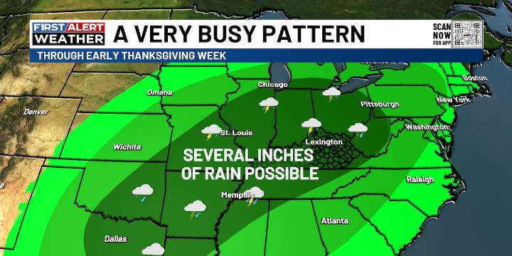
LEXINGTON, Ky. (WKYT) - A brand-new week is rolling in with temperatures right where they should be for this time of year, but don’t get too cozy with that. A surge of milder air is on the way, and it’s bringing a parade of rain and the potential for thunderstorms. This busy stretch of weather is the warm-up act for a bigger transition into winter as we head into Thanksgiving week, especially the holiday weekend.
Clouds will steadily build from the west today, and the first waves of showers and storms should sneak into far western Kentucky later this evening. This is tied to a developing area of low pressure sliding along a stalled-out boundary, and that boundary is packing a serious temperature contrast. Folks in the north and northeast may stay stuck in the 40s while the southwest tries

 KPLC
KPLC SIAdvance
 WABI
WABI RLS Media New Jersey
 KRIS 6 News Weather
 Los Angeles Times
 WWSB
WWSB KSNB Local4 Central Nebraska
 WMTV NBC15
 WNNY-TV