
 WAAY TV
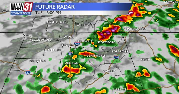
** LEVEL 1/5 SEVERE RISK TUESDAY**
Our next weather maker and cold front will bring widespread rain and the threat of few strong storms through Tuesday. Much cooler air will follow with temperatures falling back to around 50 for highs and lows at or below freezing by Thanksgiving and Black Friday.
For tonight expect to see rain and a few embedded thunderstorms moving in. Rain could be heavy at times. Some gusty wind is also possible but severe weather isn't expected with this wave of wet weather. Lows tonight will fall to around 60.
Rain will taper off during the morning Tuesday. Another round of showers and storms is expected to form around midday near or west of I-65 just ahead of a cold front. As these track east across the area through the afternoon some severe weather is possible.

 Daily Voice
 CW39 Houston
 Deseret News
 KSNB Local4 Central Nebraska
 Eyewitness News 3
 AccuWeather Severe Weather
 WMTV NBC15
 KGNS
KGNS 5 On Your Side Politics