
 Syrancuse.com
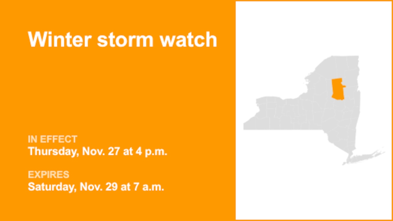
On Tuesday at 12:38 a.m. a winter storm watch was released by the National Weather Service valid from Thursday 4 p.m. until Saturday 7 a.m. for Hamilton County.
"Heavy lake effect snow possible. Total accumulations up to 10 inches within the most persistent lake effect bands. Winds could gust as high as 35 to 40 mph Thursday and Friday," states the weather service. "Greatest accumulations will occur mainly north of Route 28 and west of Route 30."
"Visibilities may drop below 1/4 mile due to falling and blowing snow. Plan on slippery road conditions. The hazardous conditions could impact the Thursday evening and Friday morning commutes," comments the weather service. "Monitor the latest forecasts for updates on this situation. During lake effect snow, the weather can vary from bands of lo

 Brainerd Dispatch
 SIAdvance
 Lehigh Valley Live
 Daily Voice
 CW39 Houston
 Deseret News
 KSNB Local4 Central Nebraska
 Eyewitness News 3
 AccuWeather Severe Weather
 WMTV NBC15