
 The Bay City Times
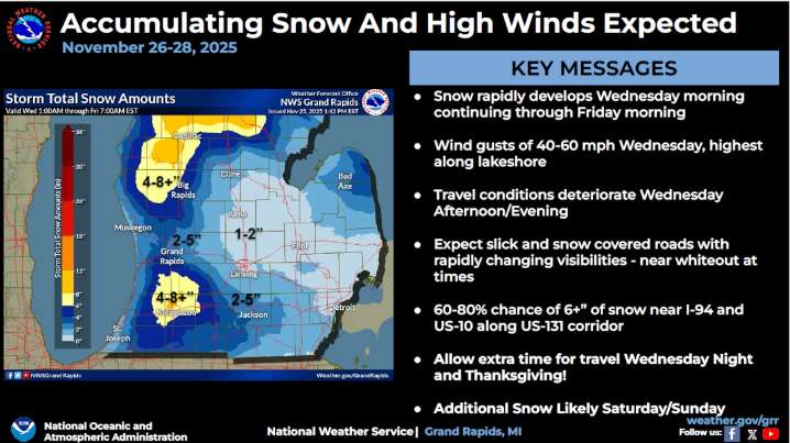
The storm system that started marching into Michigan on Tuesday night is flipping the switch to winter in a big way on Wednesday. Snow is going to develop rapidly today - and so are the winds.
Gusts are expected to ramp up to 40 to 50 mph inland today. Areas by Lake Michigan could see 60 mph winds.
These high winds will hit at the time of the heaviest snow, which is a combination expected to create hazardous travel conditions. Low visibility and near-whiteout conditions are expected in areas across the state today.
Temperatures will plunge to sub-freezing levels later Wednesday, making roads icy.
Wednesday afternoon into Thursday is expected to be the toughest time to be out on the roads.
“Travel conditions will worsen Wednesday afternoon/evening with slick and snow-covered roads and

 Newsweek Top
 Daily Voice
 Atlanta News First
 KTIV News 4
 Foreign Policy
 Cleveland Jewish News
 5 On Your Side Sports