
 WAVE 3 News
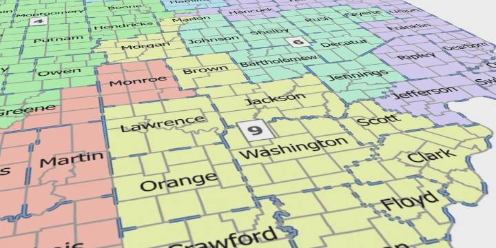
SOUTHERN INDIANA (WAVE) - A week of uncertainty, protests, and political showmanship, Hoosier lawmakers look poised to move forward with drawing new congressional lines.
Indiana House Republicans released a new map on their website Monday morning that, if passed, would shakeup the congressional maps in Southern Indiana.
Under the proposal, the existing District 9 would be divided among Districts 6, 7, and 9. All of them would lump Hoosiers living along the Ohio River with voters in Indianapolis.
Voters in Clark, Floyd, Harrison, Washington, Scott, Crawford, Orange, and Jackson Counties would remain in a District 9 that would include Southwest Indianapolis.
Jennings County would become part of District 6 which includes Central and Southeast Indianapolis.
Jefferson County would be lumpe

 Raw Story
 AlterNet
 Salon
Salon The Daily Beast
 The Babylon Bee
 Bloomberg Law