
 The Bay City Times
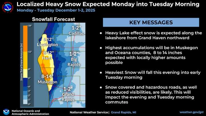
The heavy lake-effect snow totals associated with Monday night’s incoming weather system keep getting higher every time we look at them - at least for one area of Michigan.
Heavy snowfall is forecast tonight into early Tuesday along the Lake Michigan shoreline towns from Grand Haven north to Petoskey, the National Weather Service says.
All those cities are now blanketed in either a Winter Storm Warning or a lesser Winter Weather Advisory.
Here’s what the NWS is saying about the heavy snowfall in West Michigan:
The highest accumulations will be in Muskegon and Oceana counties with 8-14 inches expected. Locally higher amounts are possible especially under the heavy snow bands.
Shifts in this storm track are possible, which would affect the amounts and location of the heaviest snowfall.

 Detroit Free Press
 Battle Creek Enquirer
 America News
 Daily Voice
 WCBI-TV
 WLOX
WLOX WABI
WABI CBS Minnesota News
 Raw Story