
 KTIV News 4
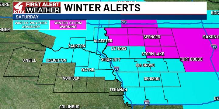
SIOUX CITY (KTIV) -
Saturday’s Forecast
Changes move in today as yet another snowmaker is poised to push through Siouxland. We’re making Saturday a First Alert Weather Day as more accumulating snow will move in with this next system.
Northern Siouxland has the best potential of the heaviest snow of 4 to 8 inches while Sioux City could end up being in a 2-4″ band, with less the farther south and west you go from Sioux City.
The snow likely begins in western Siouxland Saturday morning then progresses to the east meaning a day of snow for western Siouxland with snow picking up across eastern Siouxland through the afternoon.
Northern Siouxland is in a Winter Storm Warning for that heaviest of snow in the KTIV viewing area. Sioux City and most of the rest of Siouxland will be in a Winter W

 KCRG Iowa
 The Des Moines Register
 KWQC
KWQC Mason City Globe Gazette
 The Gazette
 KCCI 8
 Essentiallysports Basketball
 Raw Story
 America News