
Download the 27 StormTrack Weather app to receive mobile weather alerts A passing core of low pressure is expected to bring about not only scattered snowfall throughout Southern Wisconsin over the next 12 to 18 hours, but a period of freezing rain as well. The greatest likelihood for ice accumulation will occur between now and 9 o’clock this evening. A warm front lifting northward across the region will gradually drive temperatures higher, bringing an end to the potential for freezing rainfall by 9PM or 10PM. It is possible that some spots throughout the southernmost and southwesternmost reaches of the region could receive up to 0.02” of ice. That may not sound like a lot, but any amount of ice accumulation can quickly complicate travel. A Winter Weather Advisory remains in effect throu
Snow and freezing rain tonight and Wednesday morning
 WKOW 273 hrs ago
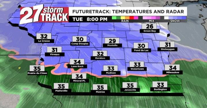
43

 WJHL
WJHL WREX
WREX Green Bay Press-Gazette
 CNN
CNN Newsmax TV
 Raw Story