
 WABI
WABI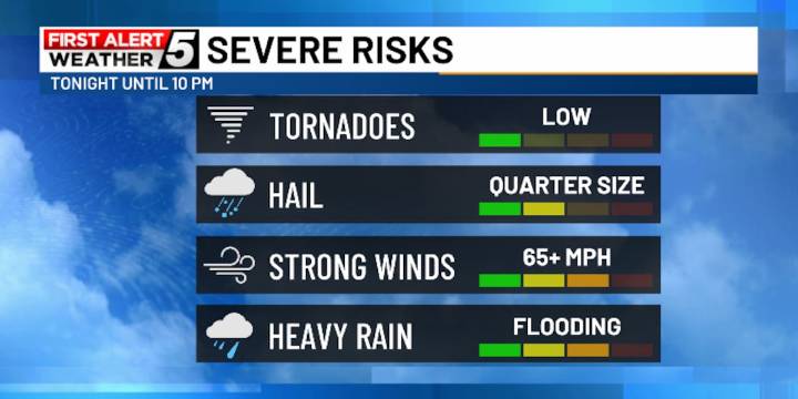
BANGOR, Maine (WABI) - A severe threat does exist for the first part of the night. A Severe Thunderstorm Watch has been issued across parts of northern and western Maine, meaning the ingredients are present for severe weather to occur.
Ahead of a cold front approaching the region, downpours and thunderstorms have started to develop. Additional sunshine today has led to warmer afternoon highs and increased instability. The humidity will also provide added moisture for these storms to feed off and will result in a threat of downpours which could lead to flooding and flash flooding.
The best threat of storms will be north & west of I-95 with an even higher risk the farther north you go. The threat of severe weather will last until about 10 PM this evening. Main hazards will be strong and da

 WKOW 27
 Siouxland News
 America News
 Eyewitness News 3
 WEVV 44News
 NBC Southern California
 FOX 32 Chicago
 KTVU San Francisco
 Statesman Journal
 FOX Business Video