
 Idaho News 6
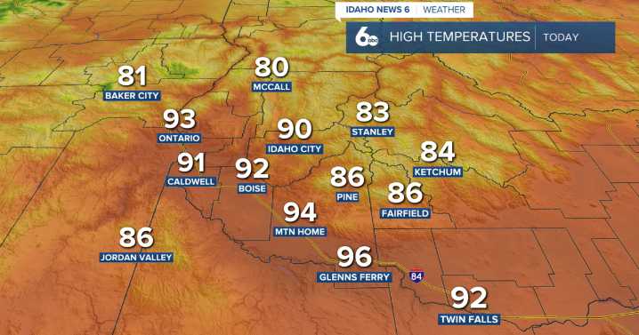
Happy Hump Day!
Temperatures are hitting their hump today, with afternoon highs rising into the lower 90s under a warm southwest flow. You might notice some light smoke lingering over western and south-central Idaho from nearby wildfires, but skies will stay mostly clear through the day.
As we head into this evening, an approaching trough and cold front will start moving through, bringing a chance for a few thunderstorms Thursday afternoon and evening, mainly in the north. Gusty outflow winds between 25-35 mph and even small hail are possible with the stronger storms. By Thursday and Friday, expect highs to fall about 10 degrees below normal, offering some much-needed relief from the summer heat. Cooler temps will stick around through Friday, but temperatures will gradually climb again t

 The Post and Courier
 WITN-TV
 Arizona's Family
 KOLO8
KOLO8 Kitsap Sun
 WAFB
WAFB Associated Press US News
 YourTango Horoscope
 Aljazeera US & Canada
 Just Jared