
 Kalamazoo Gazette
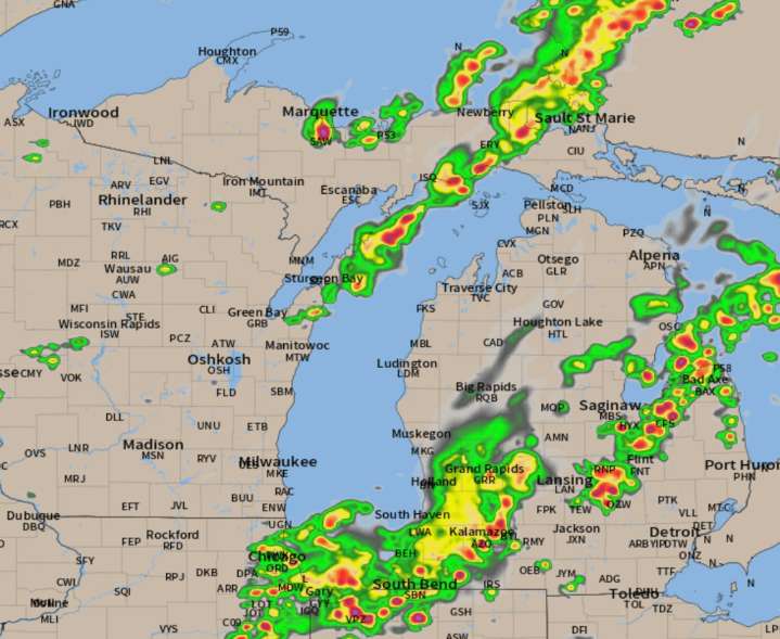
A cold front will be moving through Lower Michigan today into tonight. This will cause thunderstorms to become numerous this afternoon and evening. Eventually we will have about two days of comfortable humidity levels.
Here’s the radar forecast for today.
Thunderstorm Risk Across Michigan Today: The Lower Peninsula and eastern Upper Peninsula face a Level 1 risk(out of five levels) of severe thunderstorms today, with a 5-14% chance of scattered severe wind gusts (58+ mph). Current radar shows an east-west line of thunderstorms also developing, with increasing t-storm coverage expected throughout the day.
Potential for Significant but Spotty Rainfall: Most areas could use rain, and thunderstorms may produce substantial rainfall in short periods. It’s going to be an uneven rainfall di

 The Bay City Times
 Detroit Free Press
 NFL Indianapolis Colts
 AlterNet
 Page Six