
 Mashable
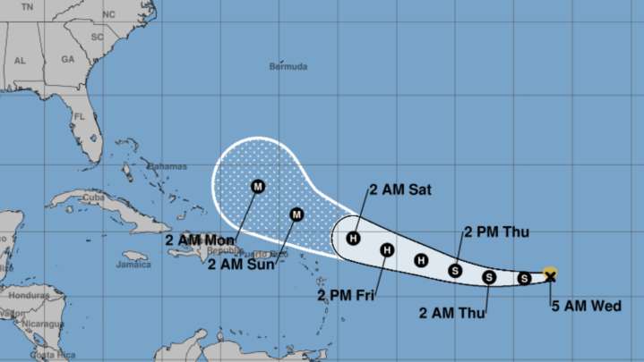
Tropical Storm Erin is expected to reach to hurricane strength as it hurtles across the Atlantic this week.
The National Hurricane Center's prediction cone shows a westward trajectory, but doesn't paint a clear picture whether or not it's likely to impact the east coast of the United States. Spaghetti models, which represent a collection of predicted paths generated by multiple computer models, paint a more definitive picture as of Wednesday morning.
All the major models show the storm turning north and eventually northeast before reaching the United States mainland, according to data and analysis shared by meteorologist James Spann .
As of Wednesday morning, Tropical Storm Erin is packing 45 mph sustained maximum wind speeds as it moves westward at 20 mph. It is expected to turn gr

 The Weather Channel
 The News Journal
 WCNC Charlotte Weather
 America News
 WTAJ-TV
 NBC News
 CBS News
 TMJ4 News
 WWSB
WWSB AccuWeather Severe Weather
 Raw Story