
 WCNC Charlotte Weather
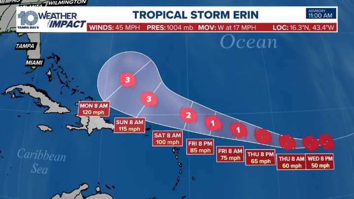
TAMPA, Fla. — The National Hurricane Center is monitoring three systems in the Atlantic, including Tropical Storm Erin, which is forecast to become the first hurricane of the season by Friday.
As of 11 AM AST (1500 UTC), Tropical Storm Erin was located near latitude 16.3 N, longitude 43.4 W, moving west at 17 mph. This general motion will continue into Thursday, before turning more west-northwest Thursday night and into the weekend.
On its current track, Erin is likely to move near or just north of the northern Leeward Islands over the weekend. Maximum sustained winds remain near 45 mph with higher gusts, but gradual strengthening is expected to begin later today or tonight. Erin is forecast to reach hurricane strength by Friday and could continue to intensify this weekend.
Tropical-sto

 The News Journal
 Florida Today
 WYFF News 4
 America News
 WTAJ-TV
 NBC News
 CBS News
 TMJ4 News
 AccuWeather Severe Weather
 WWSB
WWSB Week | 25 News Now Sports