
 Orlando Sentinel
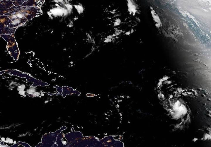
Tropical Storm Erin on Thursday began to intensify with the National Hurricane Center projecting it to become the season’s first hurricane on Friday and grow into a major Category 3 hurricane this weekend, but its path looks to steer it clear of landfall for now.
As of the NHC’s 5 a.m. advisory, the center of Erin was located about 990 miles east of the northern Leeward Islands in the Caribbean moving west at 17 mph with maximum sustained winds of 50 mph. Tropical storm-force winds extend out 60 miles.
“This general motion is expected to continue today, with a west-northwestward motion beginning tonight and continuing into the weekend,” said NHC hurricane specialist Larry Kelly. “On the forecast track, the center of Erin is likely to move near or just north of the northern Leeward Island

 USA TODAY National
 CBS Philly
 FOX 13 Tampa Bay
 America News
 Associated Press US and World News Video
 KPTV Fox 12 Oregon
 NBC 6 South Florida
 Kitsap Sun
 WCTV
WCTV WCNC Charlotte Weather
 KNOE
KNOE Wilmington Star-News Sports