
 WESH 2 News
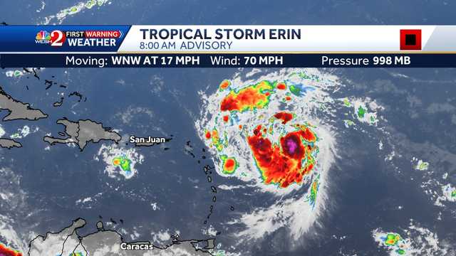
Tropical Storm Erin is expected to become a hurricane on Friday, according to the National Hurricane Center.
As of the 8 a.m. advisory, Erin was located about 580 miles east of the Northern Leeward Islands and had maximum sustained winds of 60 mph with a minimum central pressure of 998 mb.
On the forecast track, the center of Erin is likely to move near or north of the northern Leeward Islands over the weekend.
Related: Why it's good for Florida if Tropical Storm Erin strengthens quickly
Erin is moving west at 17 mph, according to the NHC.
The NHC said Erin could move close enough to the northern Leeward Islands, the Virgin Islands, and Puerto Rico to produce some impacts.
They could see isolated flash and urban flooding, along with landslides and mudslides, according to the NHC.

 KYTX CBS19
 WLOX
WLOX NOLA
NOLA America News
 Arizona's Family
 Orlando Sentinel
 Associated Press US and World News Video
 Florida Today
 PC World
 Cinema Blend
 Raw Story