
 NOLA
NOLA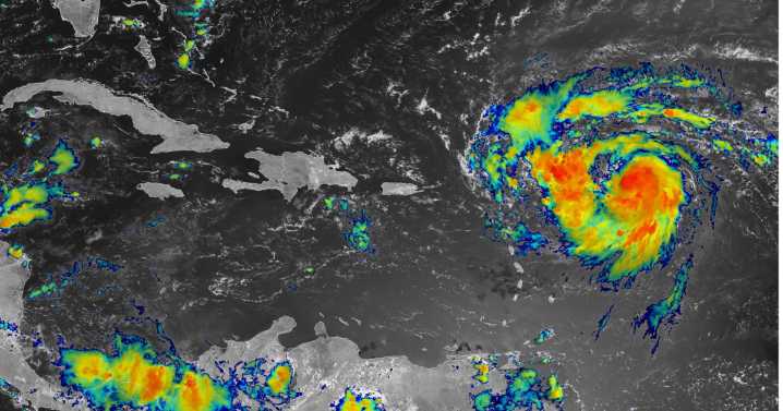
Hurricane Erin formed Friday morning, making it the first Atlantic storm to reach hurricane strength so far in 2025.
Erin was about 460 miles east of the northern Leeward Islands at 10 a.m. with winds of 75 mph and moving west northwest at 18 mph, according to the National Hurricane Center.
Forecasters said late Thursday night that the storm is expected to become a "large and formidable" major hurricane of Category 3 strength or higher over the weekend, with an increased chance for rapid intensification. Rapid intensification is defined as an increase in maximum winds of at least 35 mph in 24 hours.
Wind speeds are expected to reach up to 140 mph, or Cat 4 strength, according to the latest NHC forecast.
The hurricane does not pose an immediate threat to Louisiana, and forecasters said

 WCCB Charlotte
 FOX 4 News Arlington
 USA TODAY National
 America News
 Arizona's Family
 Orlando Sentinel
 Florida Today
 Associated Press US and World News Video
 New York Post
 Oh No They Didn't
 FOX News Health