
 The Free Press - TFP
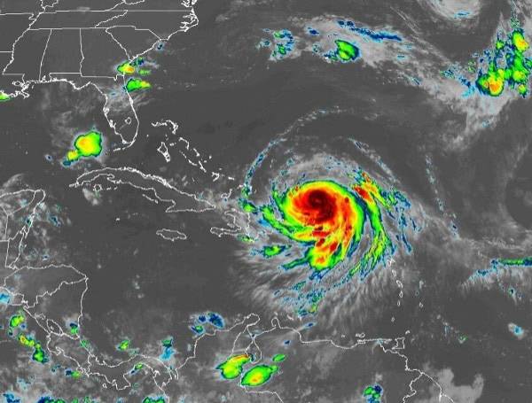
Erin’s Eye Stays Offshore, But U.S. Coast Still Faces Dangerous Impacts
Hurricane Erin, a powerful Category 3 storm, is on a path that will keep its eye over the open Atlantic, but it’s still expected to bring dangerous conditions to the U.S. East Coast this week. The hurricane’s expansive size means its far-reaching influence will be felt from Florida to the New England coast, even from hundreds of miles away.
As of Sunday afternoon, Erin had maximum sustained winds of 125 mph, a slight decrease from its Category 5 peak on Saturday. This drop in intensity is a common hurricane phenomenon known as an eyewall replacement cycle, where the storm’s old, inner eyewall dissipates and is replaced by a new, wider one.
While this process temporarily lowers the wind speed, it also expands the sto

 CNN
CNN WESH 2 News
 Florida Today
 America News
 WISC-TV Channel 3000
 FOX 13 Tampa Bay Crime
 AccuWeather Severe Weather
 New York Post
 Canada News
 Cleveland 19 News
 Asheville Citizen Times
 AlterNet