
 WDRB News
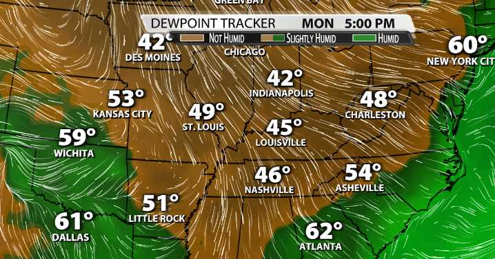
A combination of dense cloud cover and a northerly breeze has kept our afternoon temperatures a solid 10 degrees cooler than normal across most of Kentuckiana over the past few days. And with a weekend cold front, we expect temperatures to drop even lowers and the air to dry out even more.
Saturday will be a tad warmer than what we've experienced recently. Expect highs to top out in the 80s area-wide with a mix of sun and clouds. The cold front will swing across the region Saturday night and Sunday morning.
Temperatures will be below average all of next week. Highs will struggle to get into the 80s on Sunday just behind the cold front. Monday and Tuesday will keep our high steadily in the middle and upper 70s.
Not only will temperatures drop, but the ever-present summer humidity will fi

 KETV NewsWatch 7
 The Washington Post
 WOWT
WOWT Santa Maria Times Safety
 NECN Providence
 WWSB
WWSB KSNB Local4 Central Nebraska
 KOMU 8
 KPTV Fox 12 Oregon