
 The Bay City Times
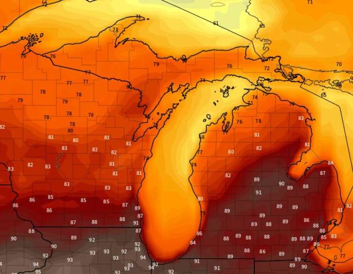
The extended weather forecast data shows a strong warm-up from our current temperatures. Let’s take a look at when, how warm and how long.
Let’s start with the overall general temperature forecast from the long-range forecasters at NOAA. The 8-to-14 day temperature forecast shows the warmer than normal temperatures spreading into Michigan from the west.
The computer models we look at are showing an even faster and more aggressive warm-up coming, which starts this coming Monday and continues warming possibly into next weekend.
Here’s a little more technical way to see the warm-up. Let’s look at the best model’s upper-air forecast from now out to the next 15 days. The model shows when the upper-air is colder than usual, like now, and when it goes warmer than normal.
We see the cold atmos

 The Weather Channel
 KTVB 7
 KSNB Local4 Central Nebraska
 Joplin Globe
 WBKO
WBKO New York Post
 FOX Weather
 NewsTalk 1280
 PennLive Pa. Politics