
 21Alive News
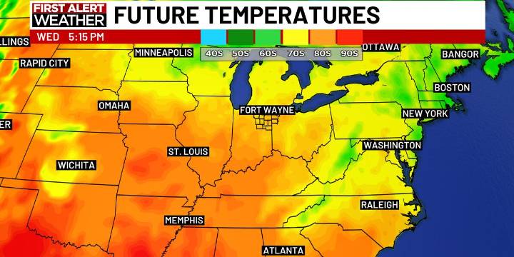
FORT WAYNE, Ind. (WPTA) - Today is the start of the transition back to summer-like weather as high temperatures are expected to be in the mid 70s. A few degrees warmer than Sunday.
We’ll add a few degrees each day as the heat slides eastward. So, Tuesday will be in the upper 70s, Wednesday in the low 80s, and high temperatures in the mid 80s are expected for the rest of the week and through the weekend.
During this time, rain chances are very minimal. Afternoons will be dry and mostly sunny with cooler, clear overnights. The only chance for rain, right now, out of the next 7 days looks to be late Saturday into Sunday morning. However. That chance for rain is not a slam dunk as some of the details with that potential weather maker are ironed out over the next few days.

 KOMU 8
 IndyStar
 WHNT News 19
 People Crime
 WEVV 44News Crime
 WTHR Crime
 The Times of Northwest Indiana Crime
 AlterNet
 Associated Press US and World News Video
 5 On Your Side Politics