
 WSMV 4 Nashville
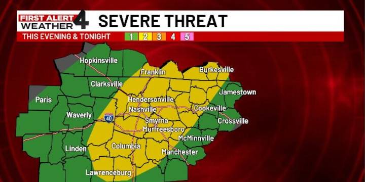
NASHVILLE, Tenn. (WSMV) - Big weather changes are coming Friday and into next week.
Today is a First Alert Weather Day due to the threat of strong to severe thunderstorms across Middle Tennessee and Southern Kentucky.
The severe threat is a level 2/5 on the scale for much of the Midstate
An isolated thunderstorm cannot be ruled out early this afternoon, but we’re mostly watching a window between 4 -11 p.m. for our highest risk for severe weather.
The main storm threats will be heavy rain and damaging winds, but storms could also have small hail, and I cannot rule out an isolated tornado.
Two First Alert Weather Days are expected on Monday and Tuesday morning for the first freeze of the season in the second week of November.
Nashville’s expected start temperature will be 30 de

 WSAZ NewsChannel 3
 WBRC
WBRC KFVS12
 WRCB-TV
 Action News 5 Crime
 WVLT
WVLT Plano Star Courier Sports
 The List
 Blaze Media
 RadarOnline