
 WESH 2 News
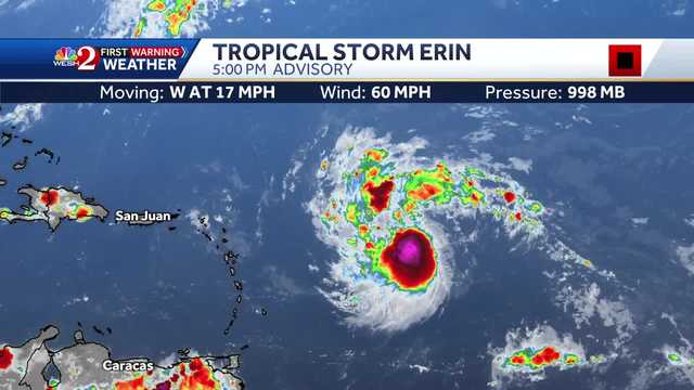
Tropical Storm Erin is expected to become a hurricane on Friday, according to the National Hurricane Center.
As of the 5 p.m. advisory, Erin was located about 890 miles east of the Northern Leeward Islands and had maximum sustained winds of 60 mph with a minimum central pressure of 998 mb. That's a slight drop in pressure from the 11 a.m. update.
A turn toward the west-northwest is expected Thursday night and expected to continue into the weekend.
On the forecast track, the center of Erin is likely to move near or just north of the northern Leeward Islands over the weekend.
Related: Why it's good for Florida if Tropical Storm Erin strengthens quickly
Erin is moving west at 17 mph, according to the NHC.
The NHC said Erin could move close enough to the northern Leeward Islands, the

 WSJM
WSJM USA TODAY National
 Orlando Sentinel
 America News
 Associated Press US and World News Video
 KPTV Fox 12 Oregon
 NBC 6 South Florida
 Kitsap Sun
 WCTV
WCTV WCNC Charlotte Weather
 KNOE
KNOE Raw Story