
 WVTM 13
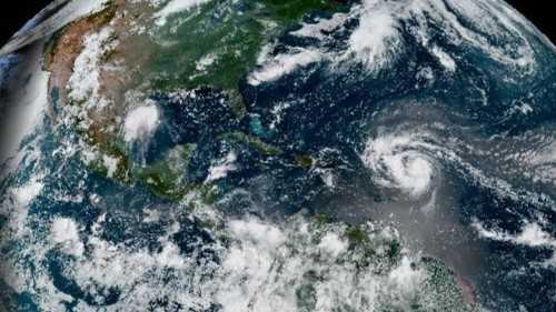
FULL FORECAST | FIRST WARNING LIVE RADAR | | UPLOAD YOUR WEATHER PHOTOS
The National Hurricane Center is tracking a disturbance in the Gulf near Mexico while watching the path of Hurricane Erin.
>> Maps and Models: Tracking Erin
This is the first hurricane in the Atlantic this season. September 10 is historically the peak of hurricane season, so you can expect tropical activity to ramp up in the weeks to come.
A few strong waves will emerge from the African coast in the near future and drift westward through the Atlantic. This is the time of year we watch for these developing storm systems to trek across the Atlantic. They have plenty of time to organize as they move through very warm waters, and the environment becomes even more favorable once they reach the Caribbean.

 The Weather Channel
 11Alive
 Sarasota Herald-Tribune
 Hattiesburg American
 America News
 Arizona's Family
 Orlando Sentinel
 Associated Press US and World News Video
 Slate Politics
 The Hollywood Reporter Movies
 Mediaite
 FOX News Health