
 ABC57 News
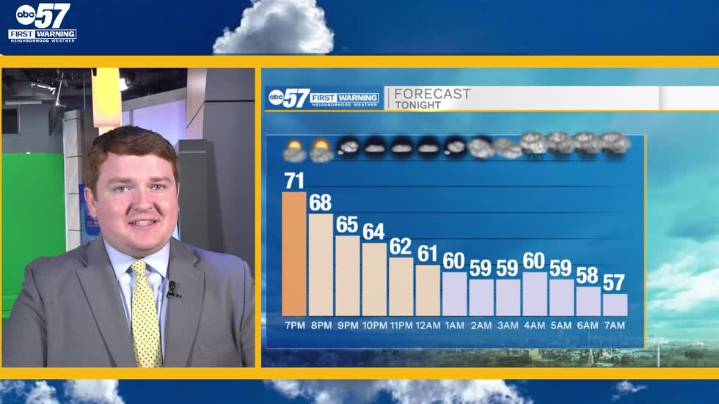
To view this video please enable JavaScript, and consider upgrading to a web browser that supports HTML5 video
High pressure has temporarily established itself across the northern Midwest and Great Lakes regions today, providing Michiana with a dose of, what will likely be, the warmest weather of the week today. After starting off in the 40s this morning, our area sees the mid to upper 70s by this afternoon amidst plenty of sunshine and light wind. Tonight, clear skies turn gradually cloudier as an incoming barrage of low pressure drags along a cold front through Michiana. Showers will begin after midnight tonight, turning heavier and more widespread throughout tomorrow morning. Thunderstorms are unlikely but not impossible and severe weather is not expected at all tomorrow. From Thursda

 Detroit News
 Jackson Citizen Patriot
 Lansing State Journal
 The Bay City Times
 Michigan Chronicle
 Battle Creek Enquirer
 Ann Arbor News
 The Grand Rapids Press
 Wilmington Star-News Sports