
 WVEC
WVEC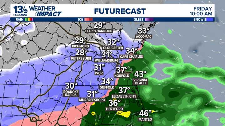
NORFOLK, Va. — Dry weather is expected through Thursday before our next system approaches at the end of the week.
By Friday, a developing area of low pressure tracking toward the Southeast and Mid-Atlantic will bring our next chance for precipitation from Friday into early Saturday. While coastal areas and the immediate metro are expected to see mostly rain, colder inland locations may experience a different story.
LATEST FORECAST
Temperatures from central to southern Virginia—especially along and west of the I-95 corridor—are forecast to sit at or below freezing during the morning hours on Friday. That means there is a window of opportunity for light snow or a wintry mix to develop.
The two major computer models, and the typically more reliable European (Euro), are calling for the win

 Daily Voice
 WDBJ7
WDBJ7 Raw Story